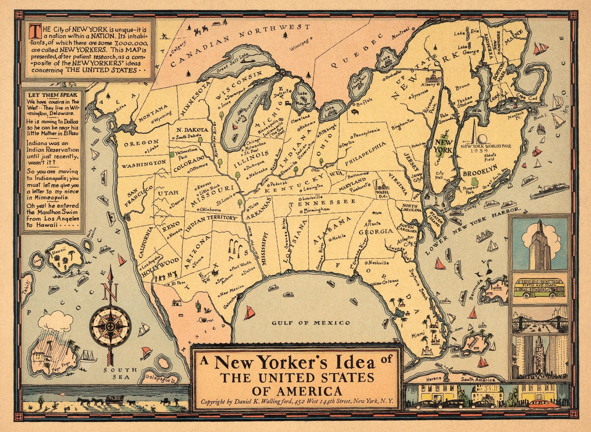
This humorous pictorial map of the United States takes the perspective of a New Yorker, with New York State shown in oversized proportion to the entire country. Some place names throughout the states are incorrect, for example, Minneapolis and Indianapolis are humorously shown together in Michigan as “The Twin Cities.” Decorative details include ships in the oceans, and various views in the borders such as the Empire State Building and a Fifth Avenue Coach bus. Explanatory texts are in two insets on the left. Compass rose on left corner of map oriented with the north to upper left. Location of 1939, New York World’s Fair grounds shown in Queens, New York. (David Rumsey Historical Map Collection)