Category: Life in the 30s
Cotton Club, 1923-1940
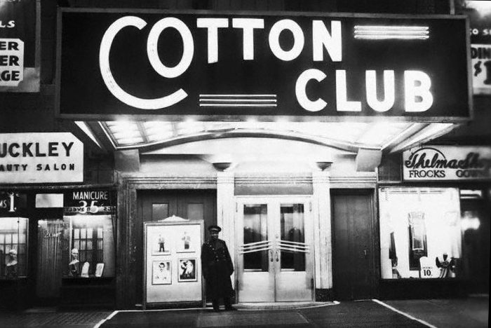
The Cotton Club was a New York City nightclub located in Harlem on 142nd Street and Lenox Avenue from 1923 to 1935, then briefly in the midtown Theater District from 1936 to 1940. The club operated most notably during the United States’ era of Prohibition. (Wikipedia)
Continue reading “Cotton Club, 1923-1940”
500th post!
Thank you to all my readers, I hope you have enjoyed the first 500 posts, there will be plenty more…
—
$500 dollar bill, series 1934A ($9310.00 in 2018)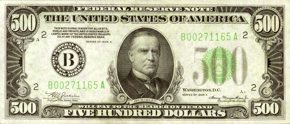 Continue reading “500th post!”
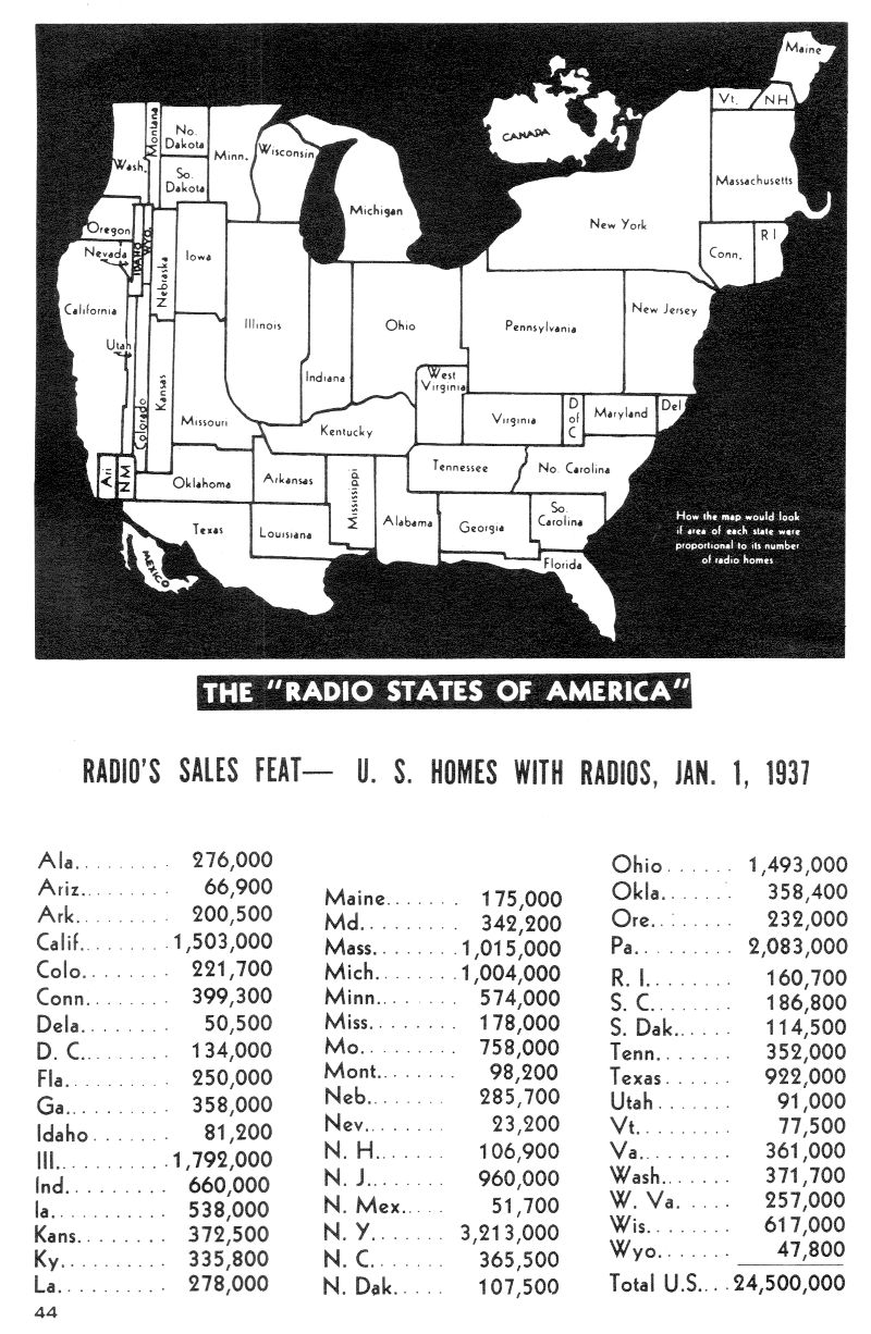
The Radio States of America, 1937
A map of how North America would look if the area of each state were proportional to its number of homes with radios.
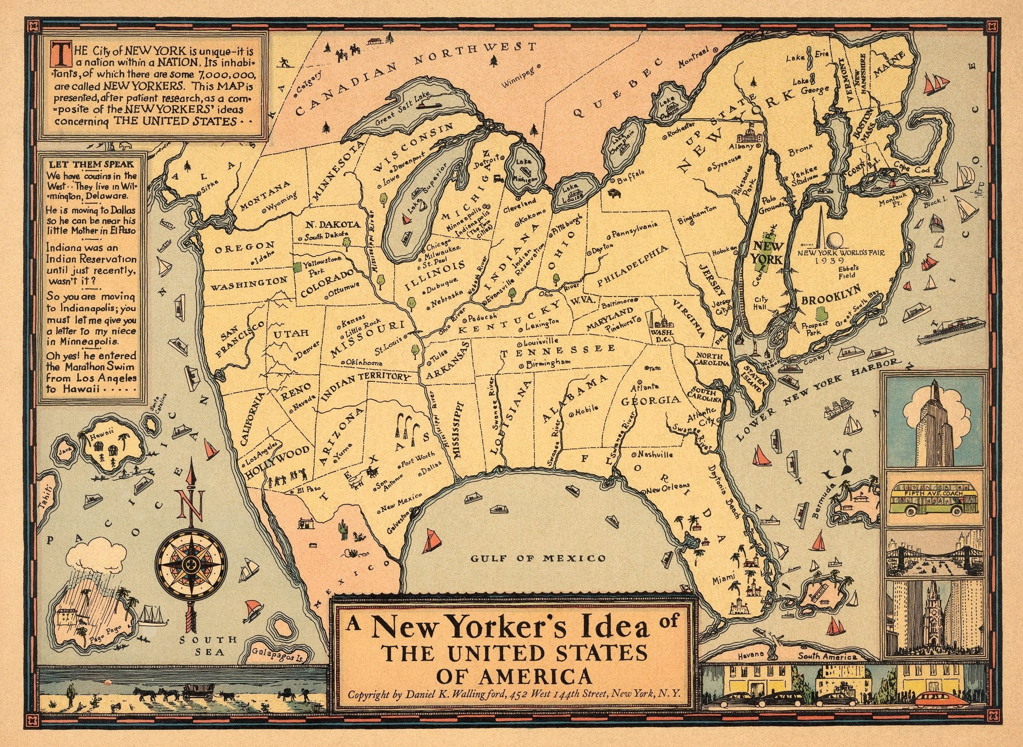
A New Yorker’s Idea of the USA, 1937
This humorous pictorial map of the United States takes the perspective of a New Yorker, with New York State shown in oversized proportion to the entire country. Some place names throughout the states are incorrect, for example, Minneapolis and Indianapolis are humorously shown together in Michigan as “The Twin Cities.” Decorative details include ships in the oceans, and various views in the borders such as the Empire State Building and a Fifth Avenue Coach bus. Explanatory texts are in two insets on the left. Compass rose on left corner of map oriented with the north to upper left. Location of 1939, New York World’s Fair grounds shown in Queens, New York. (David Rumsey Historical Map Collection)
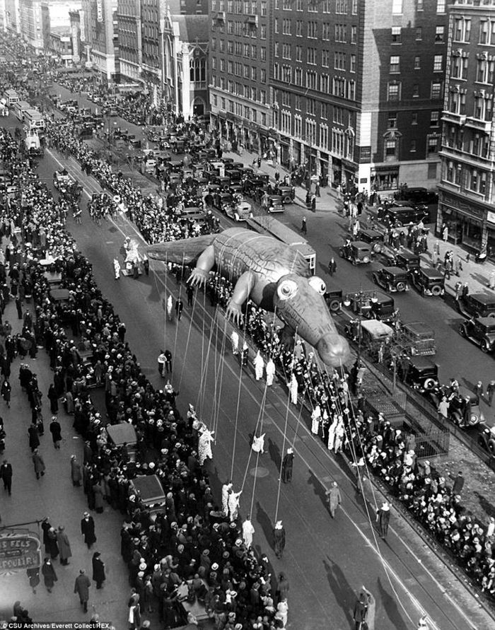
Macy’s Thanksgiving Parade, 1932
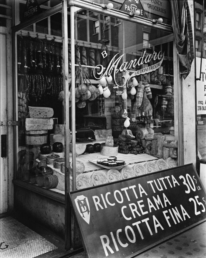
Cheese Please, 1935
Cheese Shop, Manhattan, 1935
Hooverville, Central Park, NYC, 1931-32
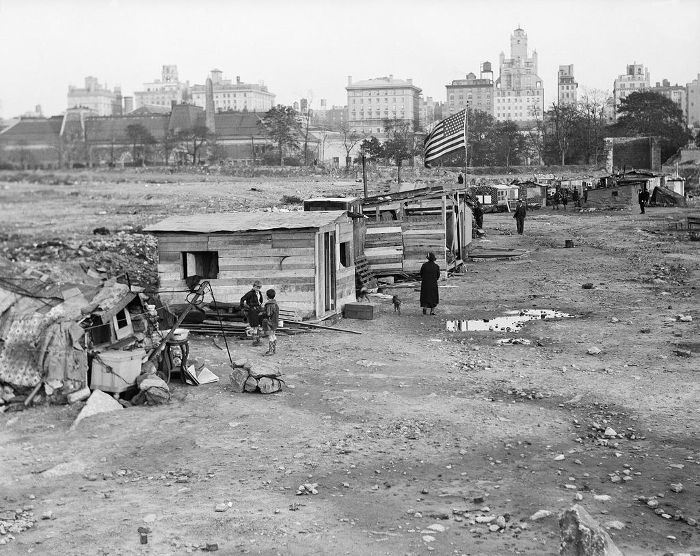 A “Hooverville” was a shanty town built during the Great Depression by the homeless in the USA. Named after President Herbert Hoover, who was blamed for the economic collapse. During the 1930s there were hundreds of these slums and hundreds of thousands of people lived in them. One of the Hoovervilles was found in Central Park, New York City where scores of homeless families camped out at the Great Lawn at Central Park, then an empty reservoir. Continue reading “Hooverville, Central Park, NYC, 1931-32”
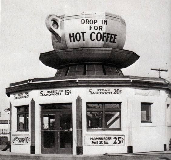
Roadside Diners – 1930s
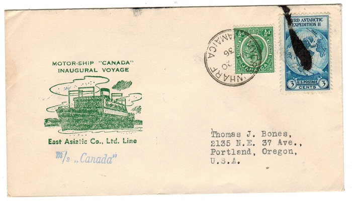
Letter from Jamaica, 1936
With 3 cent Byrd Antarctic expedition II stamp.